In the quadcopter space, Parrot may be best known for its AR.Drone and mini quads, but they're also behind two initiatives to use unmanned vehicles for aerial mapping. SenseFly and Pix4D are two departments making those vehicles and the 3D mapping software, and we learn about their latest quad at this year's CES.
This video was shot with a Sony PXW-X70 camera, which we're testing. Thanks to B&H for providing us with gear for CES! Check it out here:
Shot by Joey Fameli
Edited by Tom Crenshaw, Circa Digital
Fpvracer.lt is not the owner of this text/video/image/photo content, the real source of content is Youtube.com and user declared in this page publication as Youtube.com user,
if you have any question about video removal, what was shared by open community, please contact Youtube.com directly or report bad/not working video links directly to video owner on Youtube.com. Removed video from Youtube.com will also be removed from here.

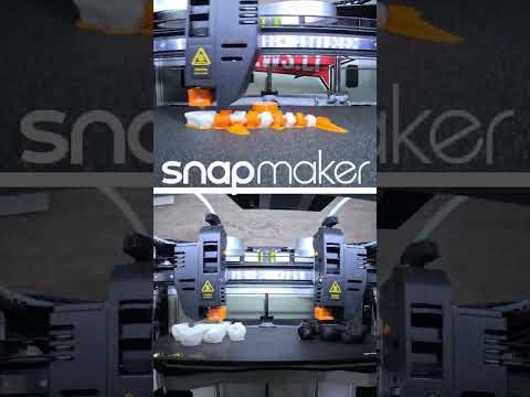 SnapMaker J1 IDEX 3d printer - double extruder workflow sample dual head print
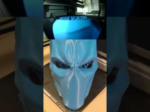 Deathstroke 3d printed wearable mask #shorts
 #DriftMolėtai "Street" drift race finals 2022