Watch more videos
-
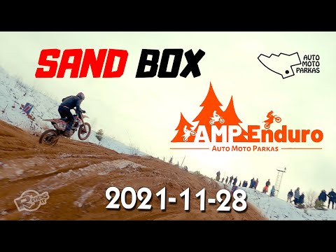 Auto moto parkas 2021-11-28 SandBOX
Auto moto parkas 2021-11-28 SandBOX Daugiau informacijos: / #sandbox #amp #moto --------------... -
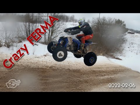 Dirt bike and quadbike event at Crazy Ferma 2022-02-06
Another great winter event for dirt lovers. This time it was really bad weather, frozen fingers,... -
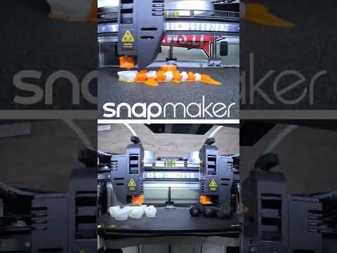 SnapMaker J1 IDEX 3d printer - double extruder workflow sample dual head print
#shorts Enjoy double extruder workflow satisfaction Music by: Gibran Alcocer - Idea 1 - piano c...